As of Jun 6, 4 PM local time.
Active Alerts and Current Conditions
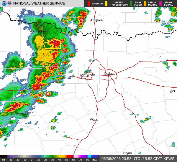
A Flood Watch with severe severity and future urgency is currently in effect for Frisco, Texas. This alert was issued by the National Weather Service in Fort Worth and remains active until the specified end time. Residents should remain vigilant as conditions evolve.
Right now, the air temperature in Frisco is 87F, with a feels-like temperature of 92F. The relative humidity stands at 55%, and the dew point is 69F. Winds are light at 6 mph, with gusts reaching up to 7 mph. The sky is currently mainly clear.
Forecast for Today and Tonight
Today, the high will be near 87F, with a low near 72F. There is a 67% chance of precipitation, primarily in the form of rain showers. According to the National Weather Service, this afternoon brings a chance of showers and thunderstorms under mostly sunny skies, with a high near 86F. South southeast winds will hover around 10 mph, and the chance of precipitation is 50%.
Tonight, conditions will shift to mostly cloudy skies with a low around 72F. The chance of precipitation rises to 80%. Showers and thunderstorms are expected before 1am, followed by continued showers and thunderstorms. New rainfall amounts between a quarter and half of an inch are possible. South southeast winds will remain around 10 mph.
Outlook for Tomorrow
Tomorrow, the high will be near 87F, with a low near 70F. The chance of precipitation is 48%, with thunderstorms expected. The National Weather Service indicates that showers and thunderstorms will occur before 7am, followed by a chance of showers and thunderstorms between 7am and 4pm.
Partly sunny skies are anticipated, with a high near 90F. Heat index values may reach as high as 102F. South winds will range from 10 to 15 mph, with gusts as high as 25 mph.