Dangerous Heat and Humidity
Frisco is currently experiencing dangerous heat conditions this afternoon. The air temperature stands at 86F, but the oppressive humidity makes it feel like 102F. Relative humidity is at 84%, with a dew point of 81F, creating a muggy atmosphere that can make outdoor activity feel strenuous. Winds are blowing from the south southeast at 10 mph, with gusts reaching 15 mph, while the sky remains clear.
Storms and Forecast
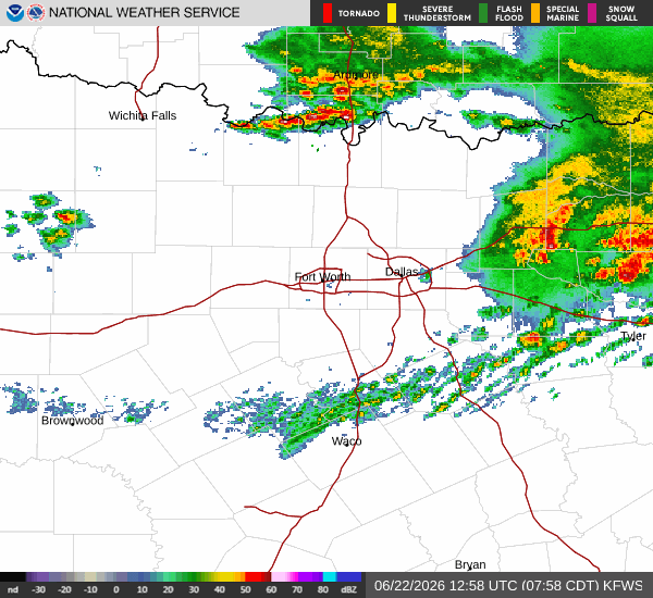
The National Weather Service indicates a significant chance of precipitation today, with a 76% probability of showers and thunderstorms. Specifically, storms are expected before 4pm, and some of these could be severe. Residents should monitor conditions closely as the day progresses. New rainfall amounts less than a tenth of an inch are possible. Temperatures today will reach a high near 91F before dropping to a low near 78F tonight.
Tonight, the chance of precipitation drops to 20%, with a slight chance of showers and thunderstorms after 7pm. Partly cloudy skies will prevail, and the heat index may remain as high as 101. Winds will continue from the south southeast at 10 to 15 mph.
Tomorrow, conditions will warm up further with a high near 95F. The heat index is forecast to reach 105, making it feel even hotter than the actual air temperature. There is a slight chance of showers and thunderstorms before 1pm, with a 22% overall chance of precipitation. Partly sunny skies are expected, with south winds at 10 to 15 mph. Overnight lows will settle around 79F under mostly clear skies, with the heat index staying as high as 103.